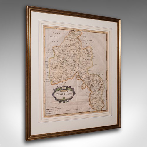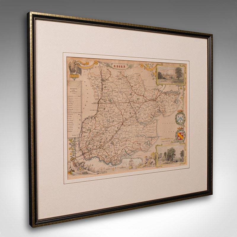
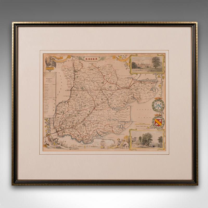

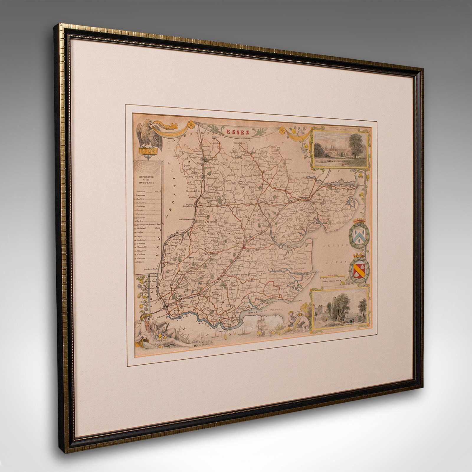
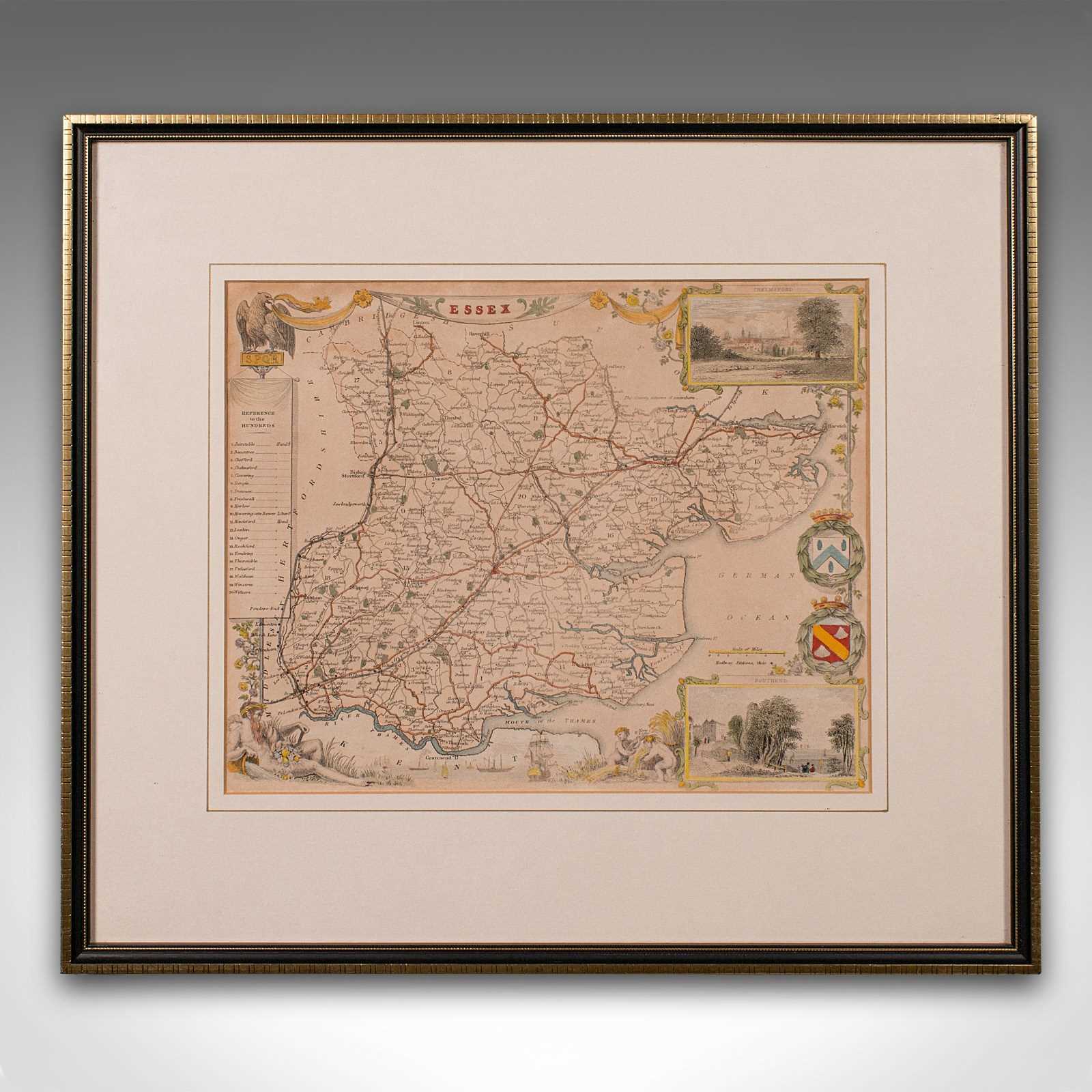
Antique County Map, Essex, English, Framed, Cartographic Interest, Victorian
Stock No
18.9978
2024
- £295.00
- €356 Euro
- $373 US Dollar
Questions about this item?
Like this item?
Item Description
Our Stock # 18.9978
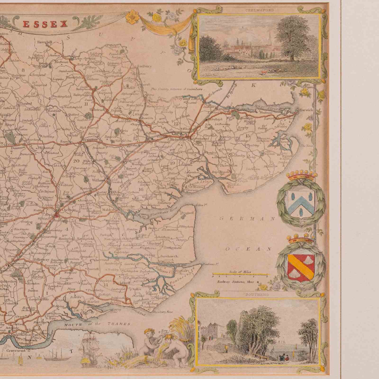
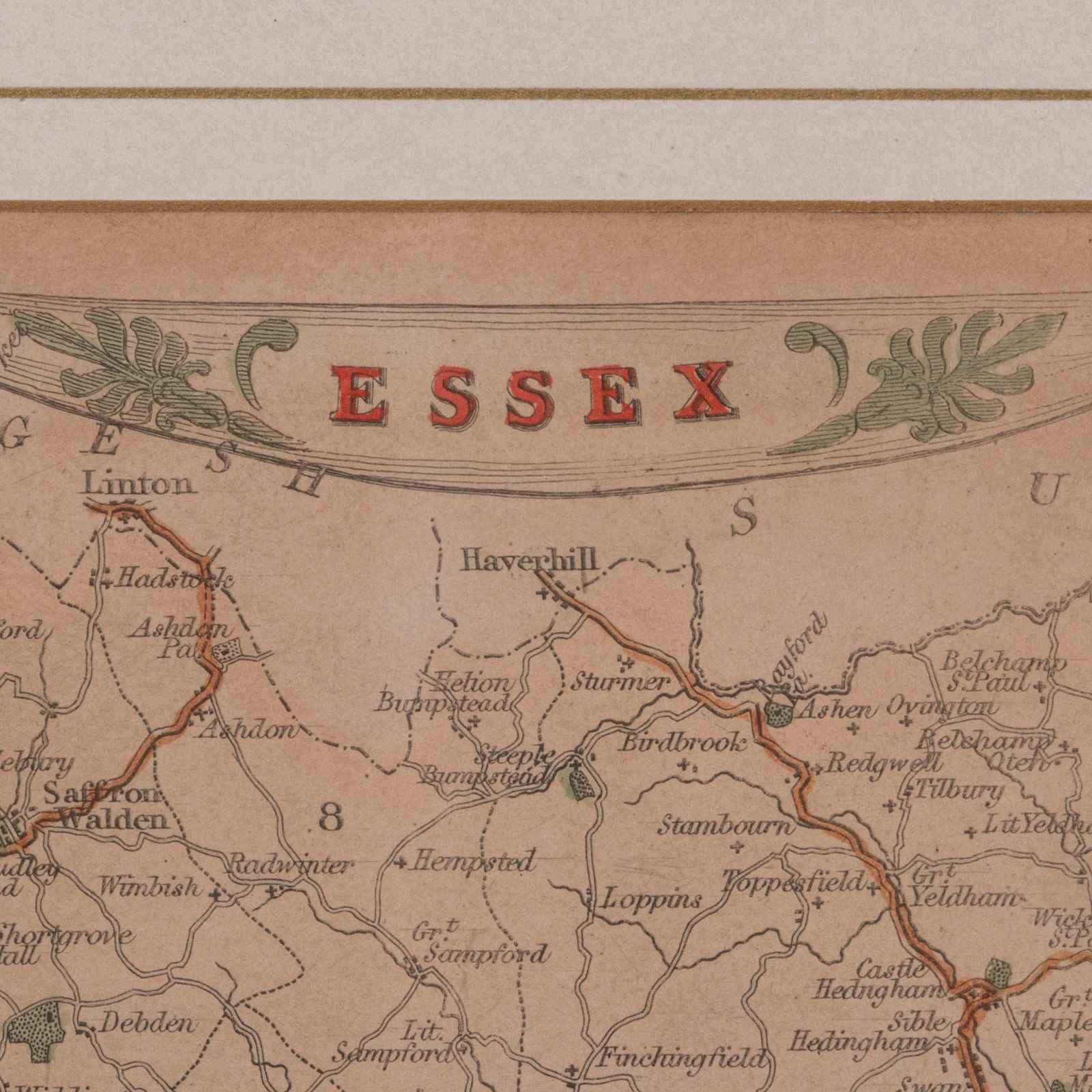
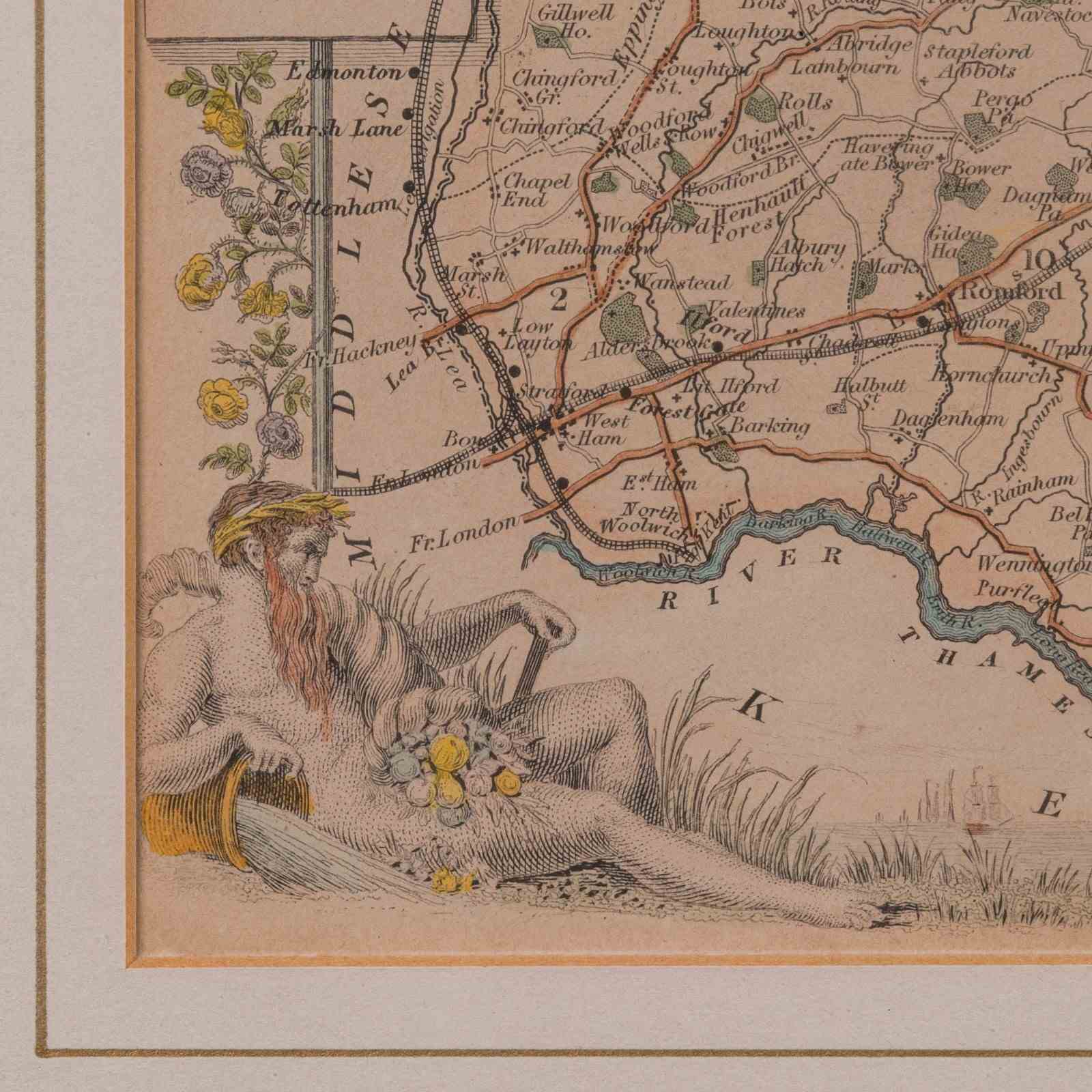
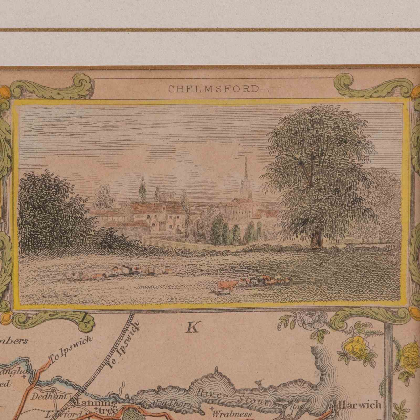
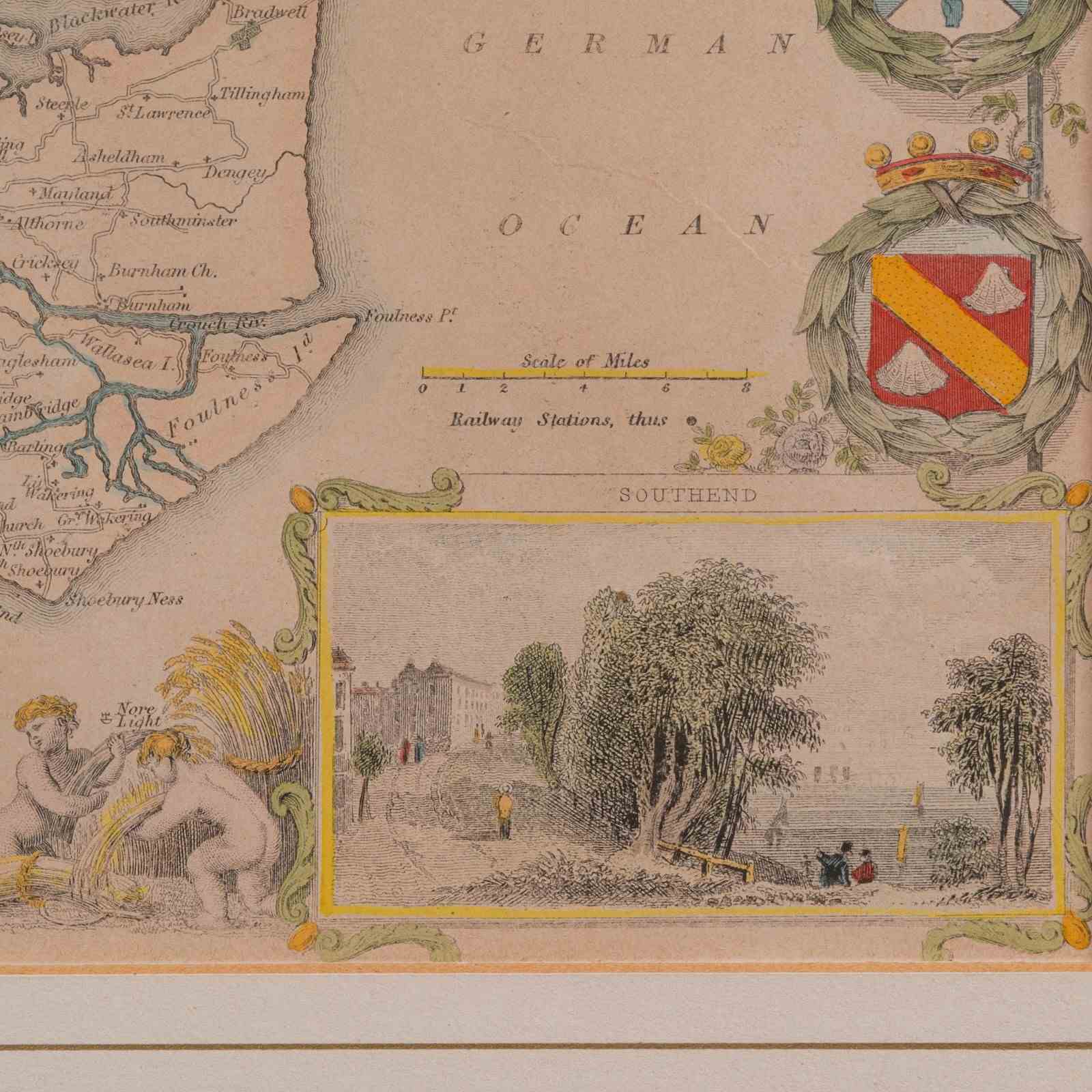
This is an antique lithography map of Essex. An English, framed atlas engraving of cartographic interest, dating to the mid 19th century and later.
- Superb lithography of Essex and its county detail, perfect for display
- Displaying a desirable aged patina and in very good order
- Appealing cartography, tastefully set within a quality, later frame
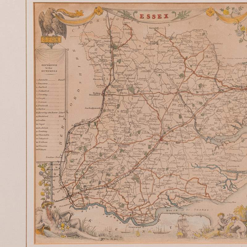
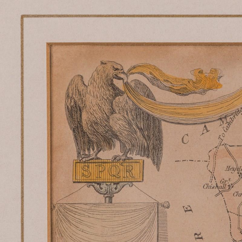
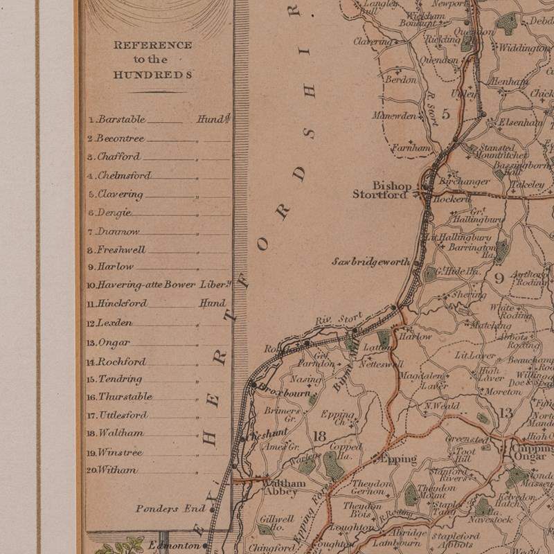
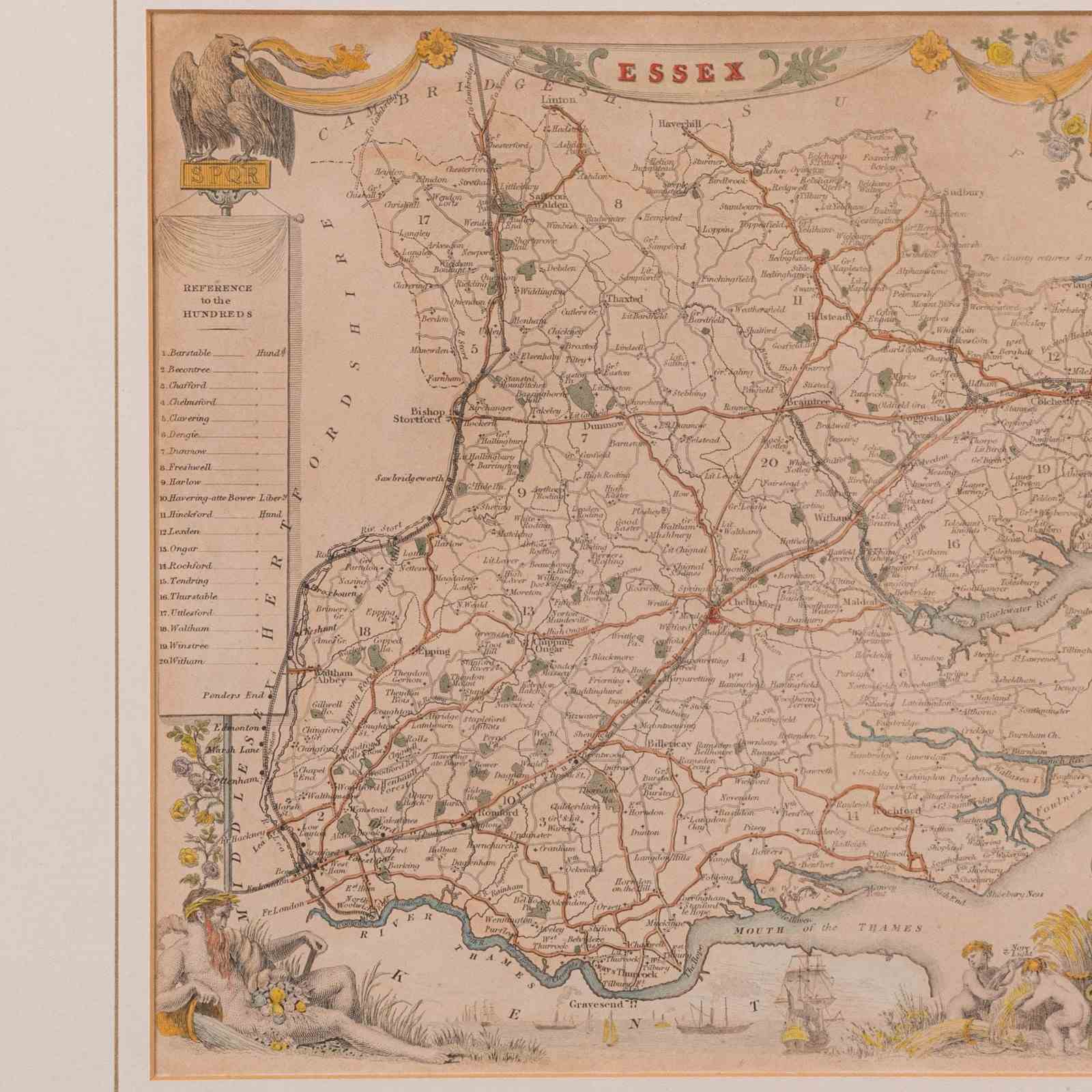
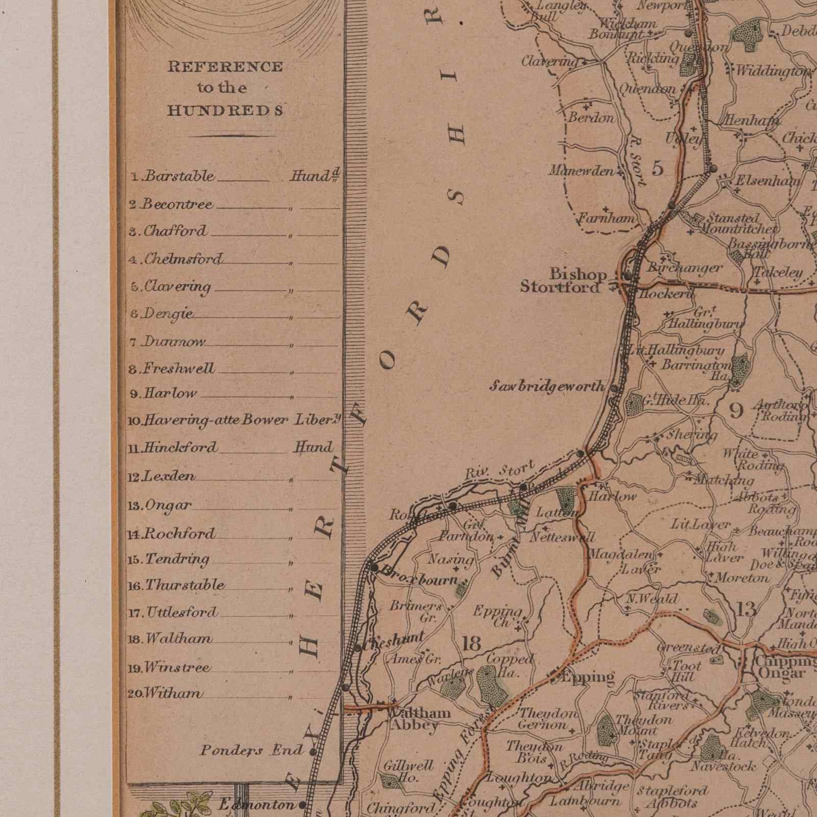
- Detail given to The Hundreds, the administrative divisions within counties until the mid 19th century
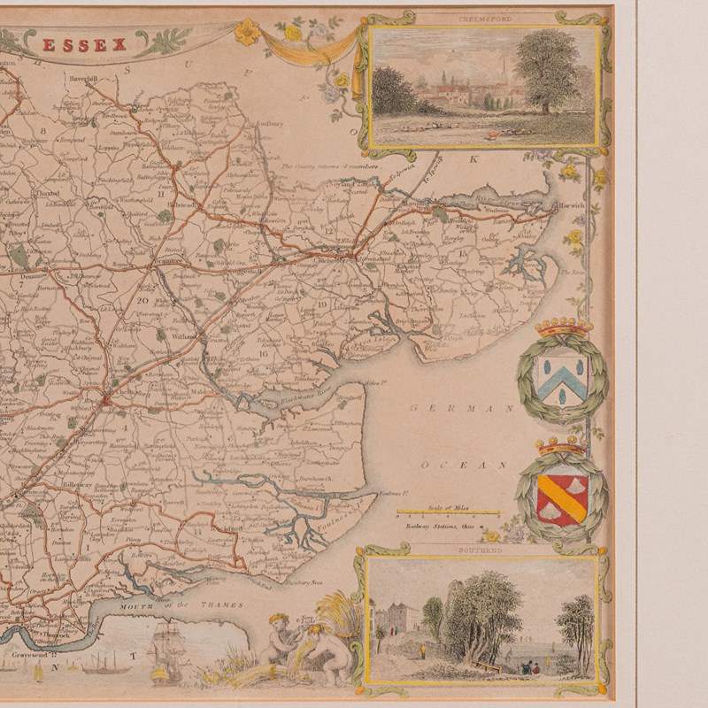
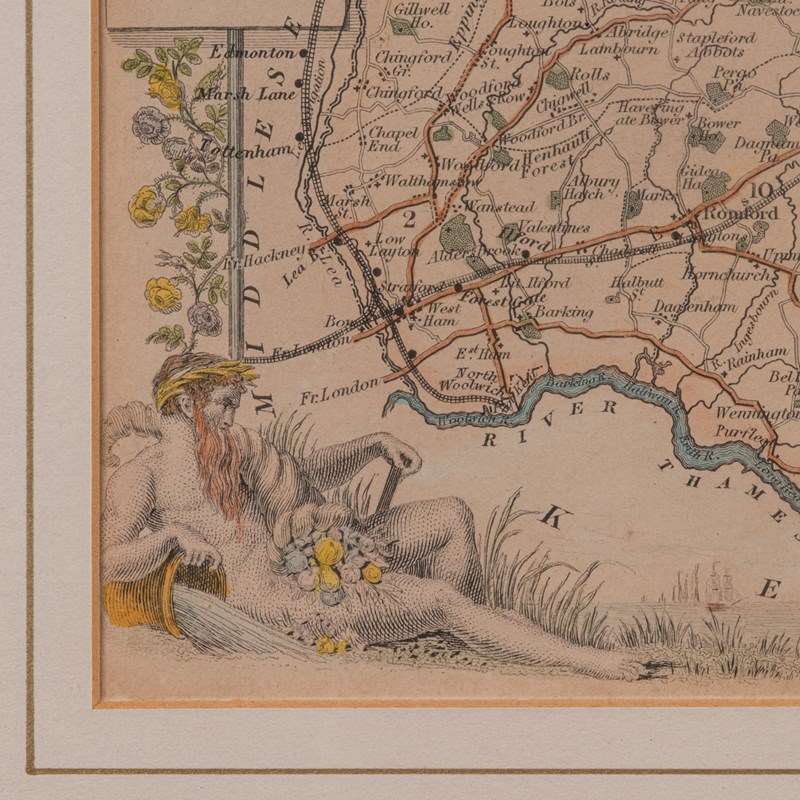
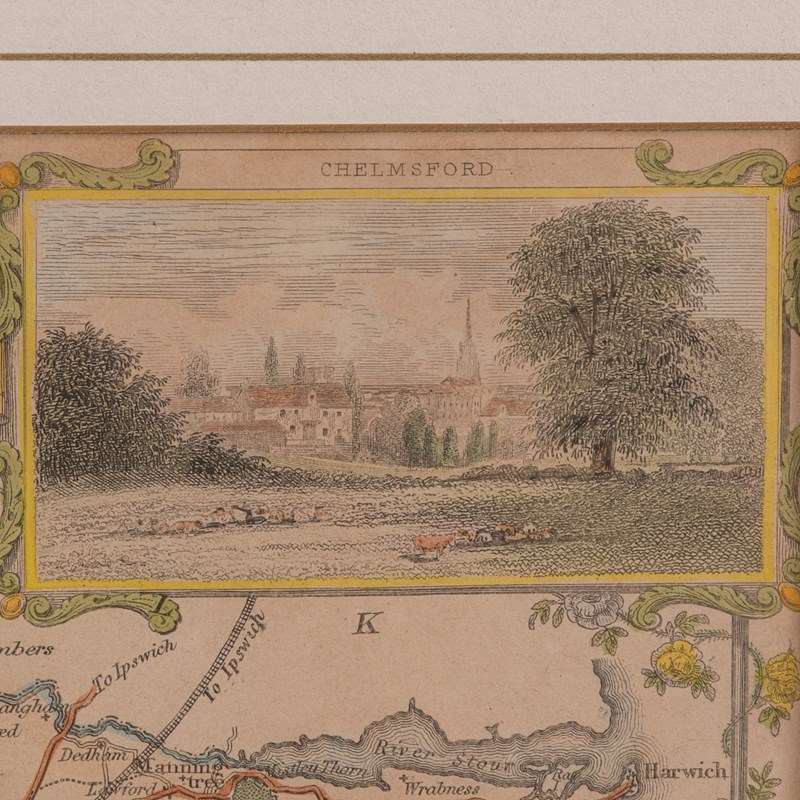
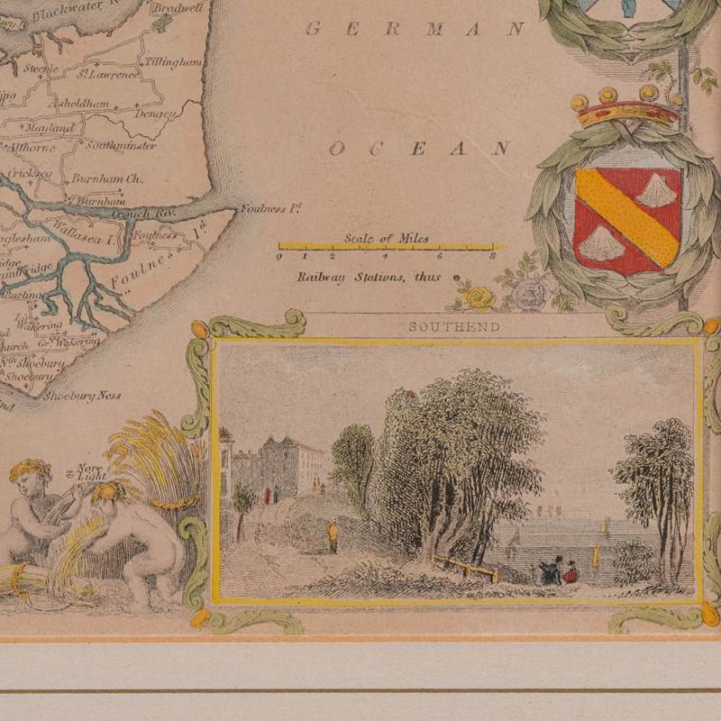
- County emblems, and places of interest in colour add fine illustrative detail
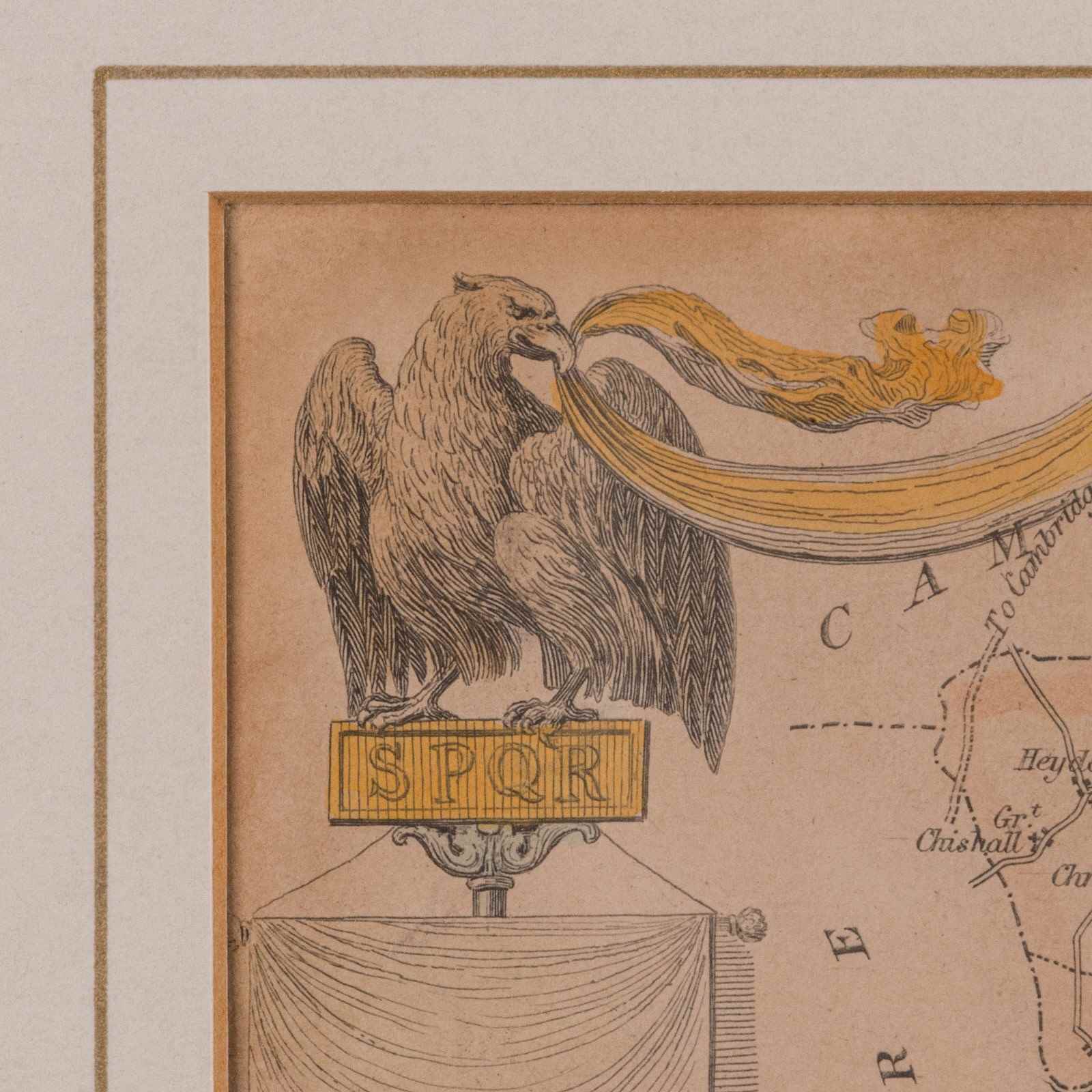
- Fascinating nod to the county's Roman past with the SPQR Eagle
- Dressed to the rear with hanging cord for ease of mounting
This is a quality antique lithography map of Essex, with fine cartographic interest. Delivered ready to display.
Dimensions:
Max Width: 39.5cm (15.5'')
Max Depth: 1.5cm (.5'')
Max Height: 35cm (13.75'')
Map Width: 26cm (10.25'')
Map Height: 20.5cm (8'')
We offer a 100% satisfaction guarantee with all of our antiques.
We ship worldwide with professional packing and attractive rates – please send us your post / zip code and country for a quote.
Free delivery to most of the U.K. – Please send us your post code for confirmation.
Deliveries taking on average ten working days to arrive at your door from receipt of payment.
Please contact us if you require any further information - we are here to help.
Our Ref: 18.9978
Item Info
Seller
Seller Location
Hele, Devon
Item Dimensions
H: 35cm W: 39.5cm D: 1.5cm
Period
c.1850
Item Location
United Kingdom
Seller Location
Hele, Devon
Item Location
United Kingdom
Seller Contact No
+44 (0)207 1833511
More from LONDON FINE ANTIQUES