


Antique Somerset Map, Thomas Kitchin, English, Cartographic Reference, Georgian
Stock No
25208
2024
- £495.00
- €580 Euro
- $660 US Dollar
Questions about this item?
Like this item?
Item Description
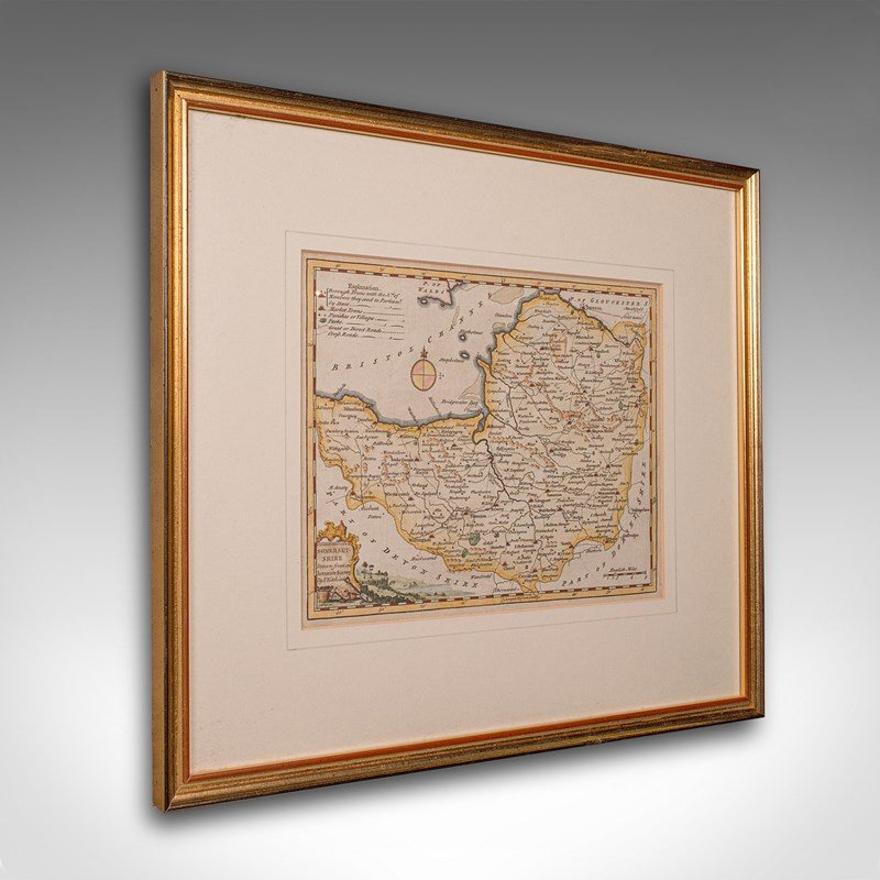
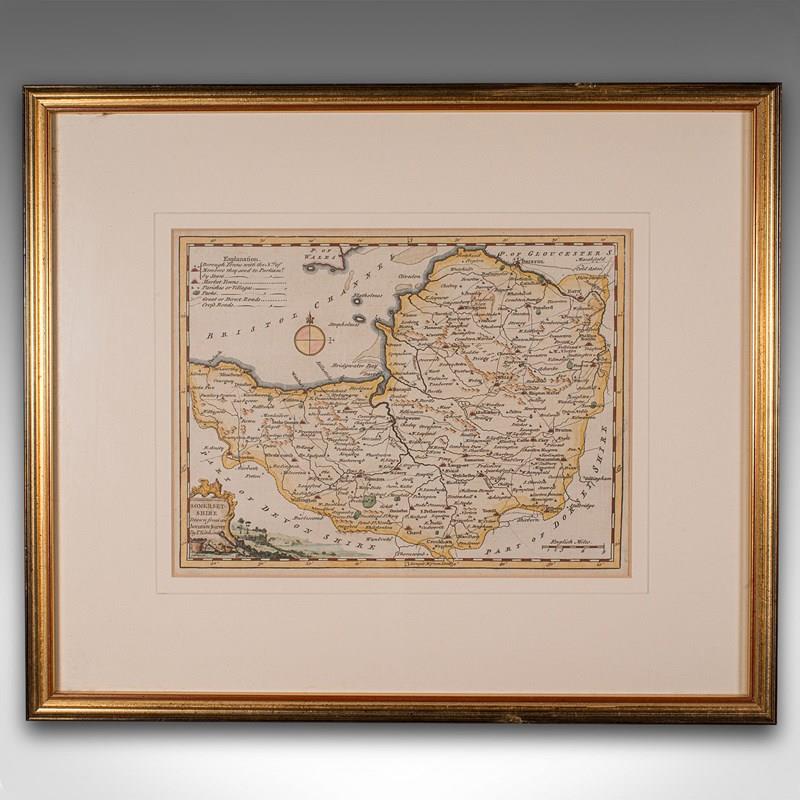
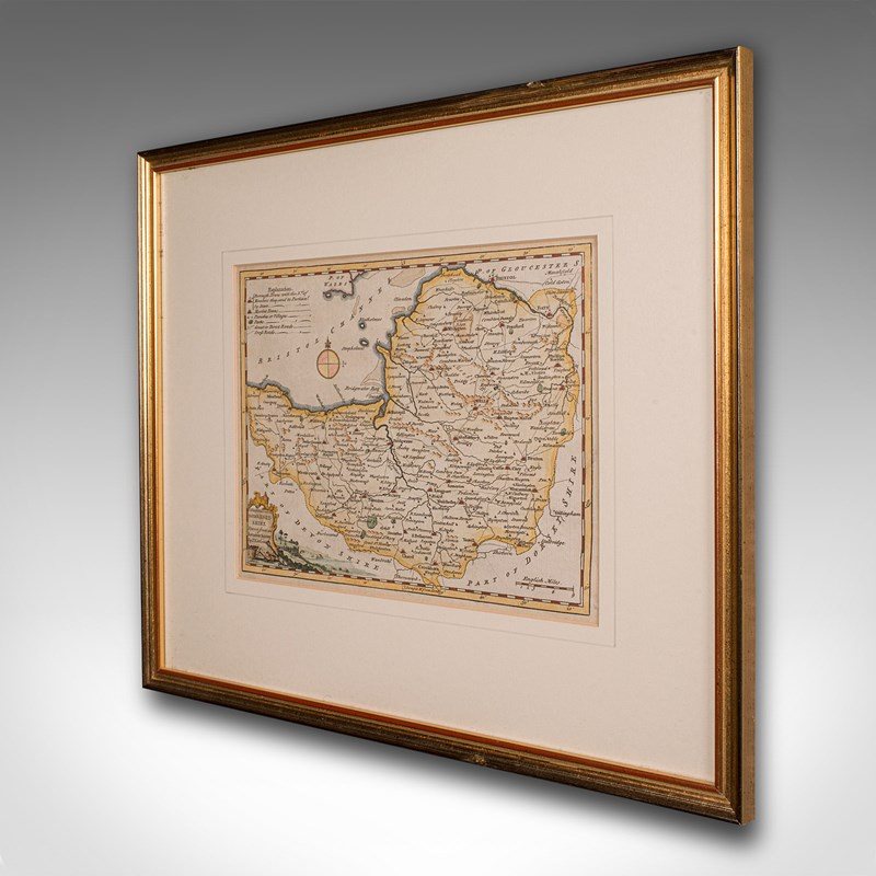
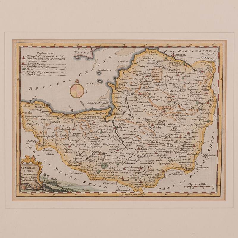
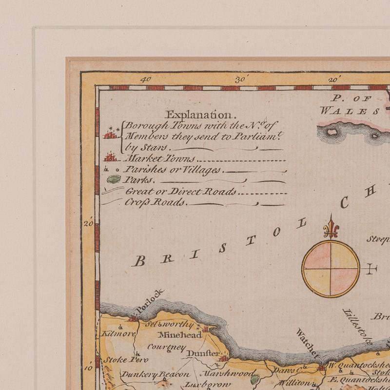
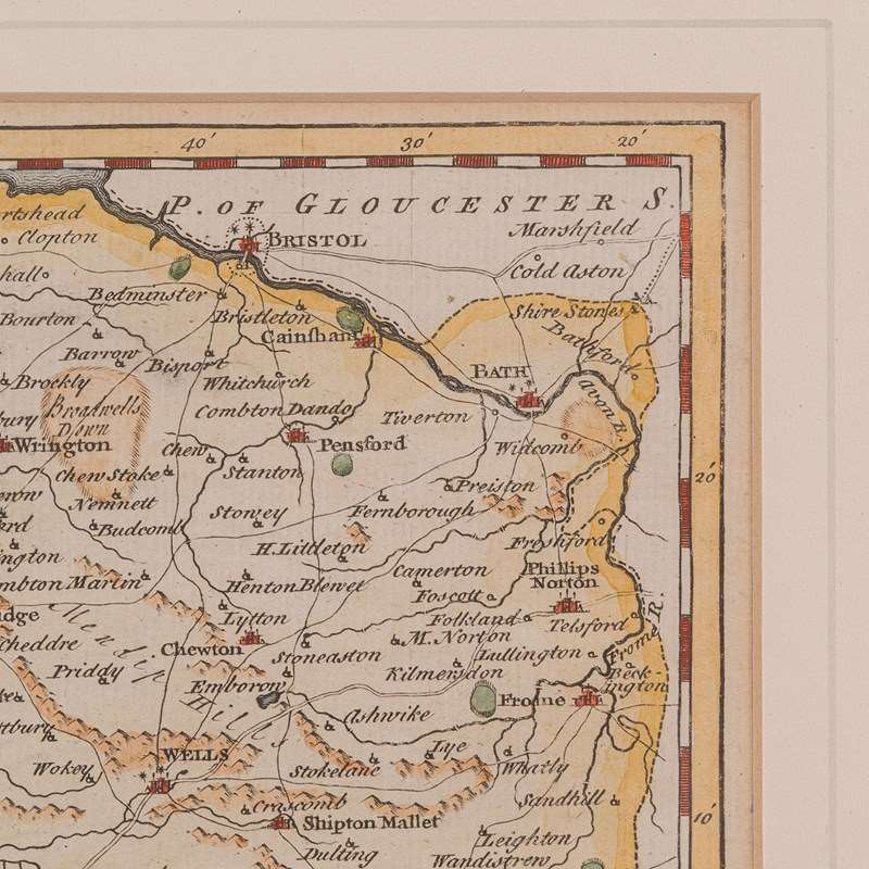
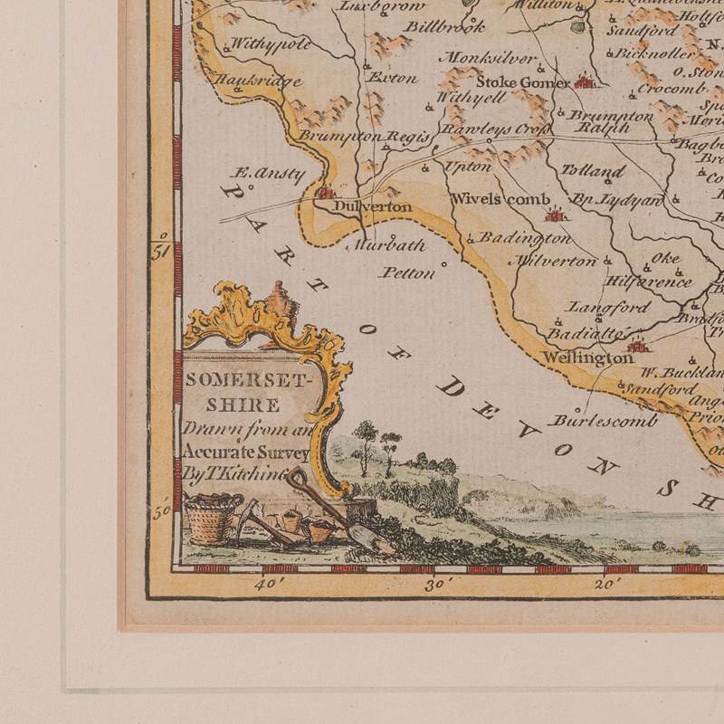
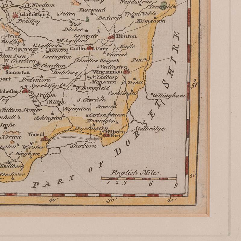
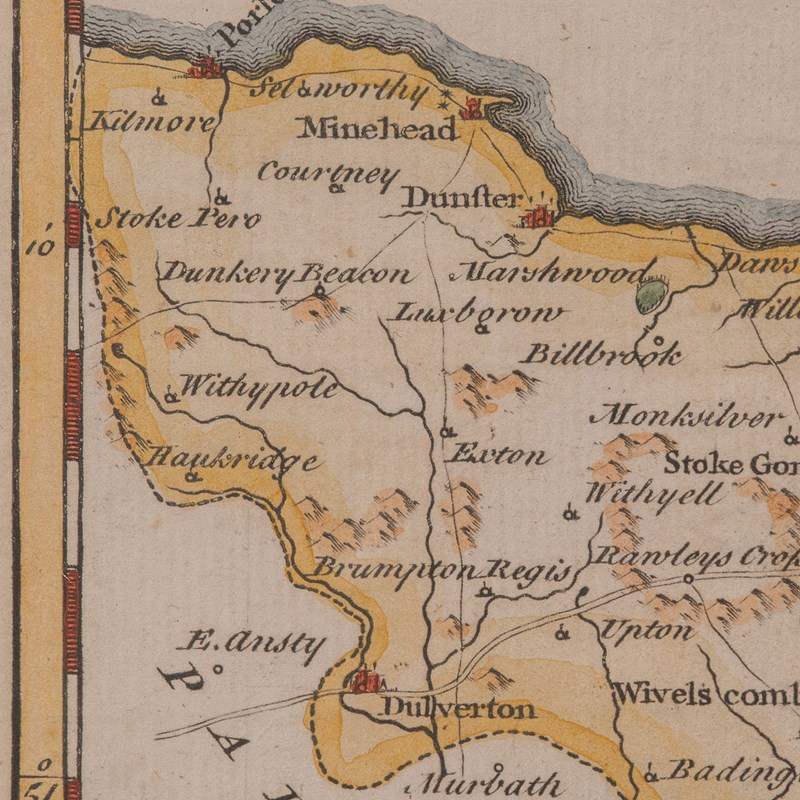
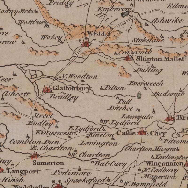
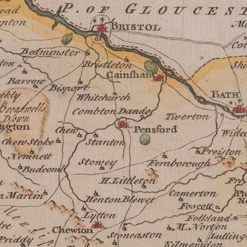
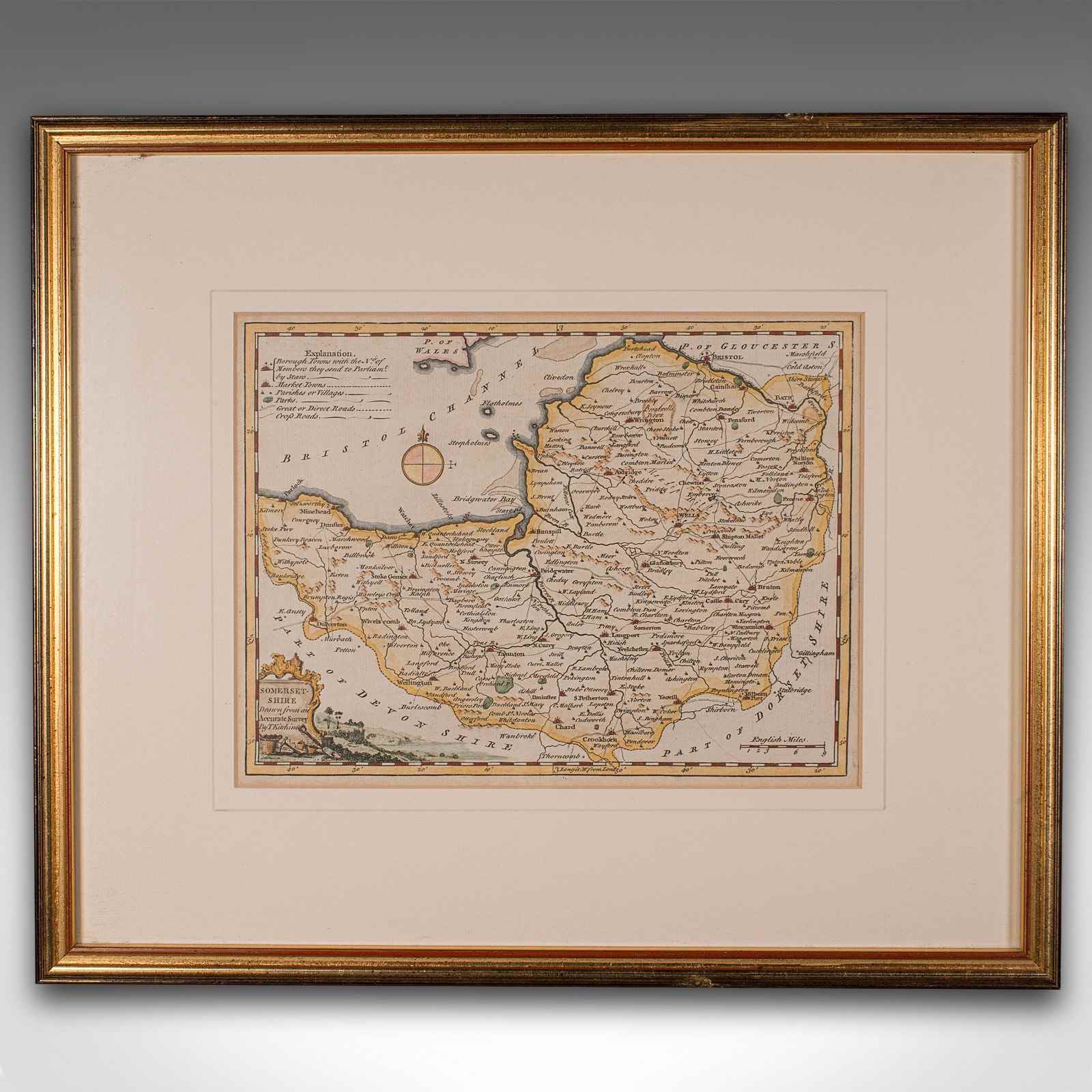
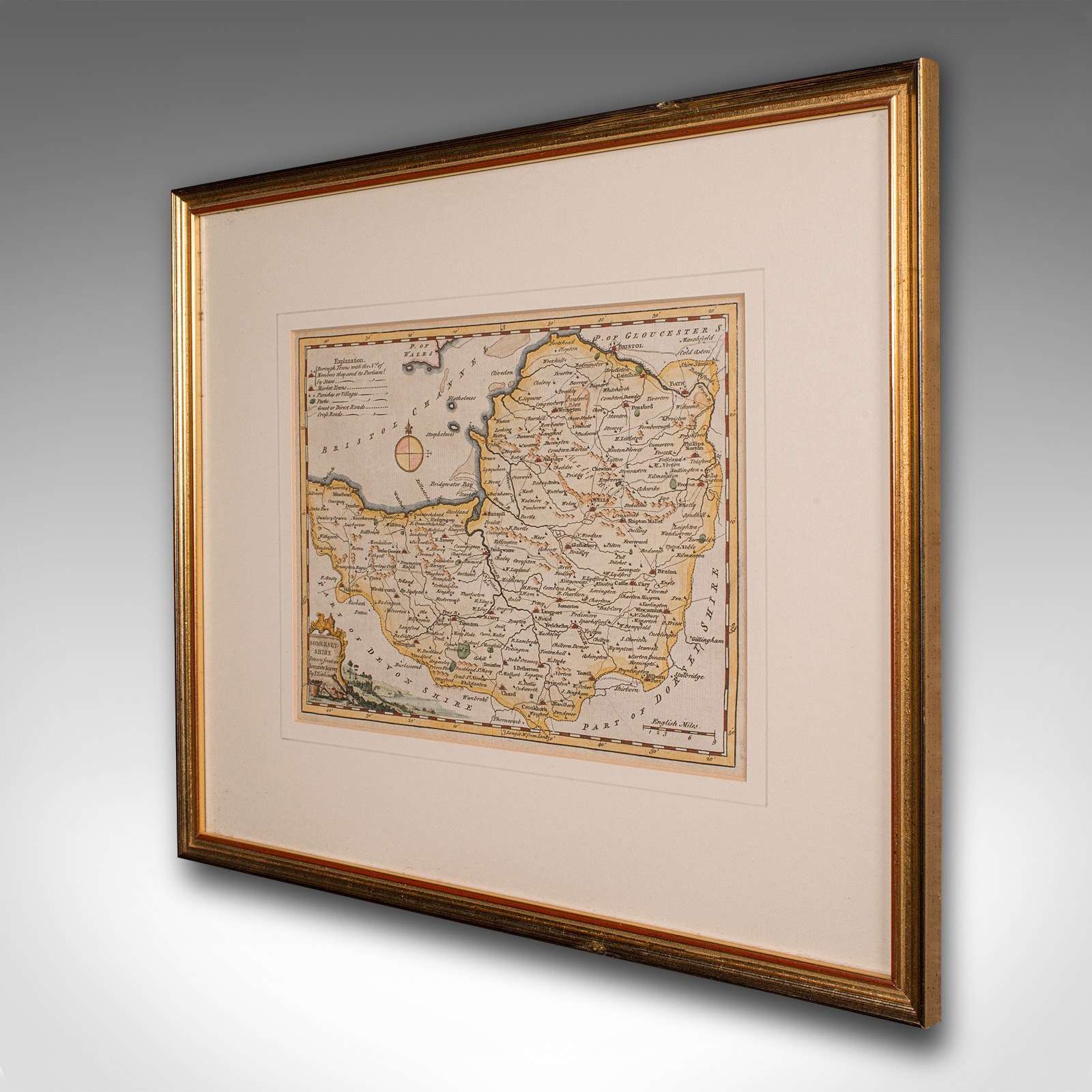
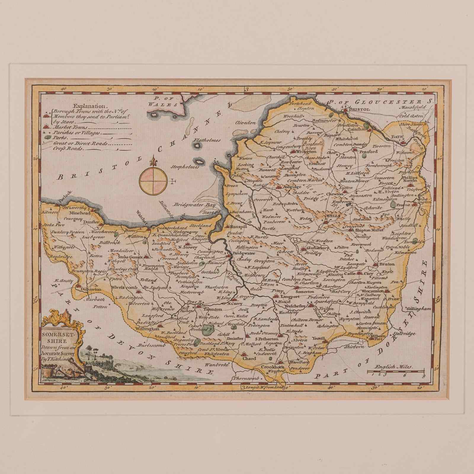
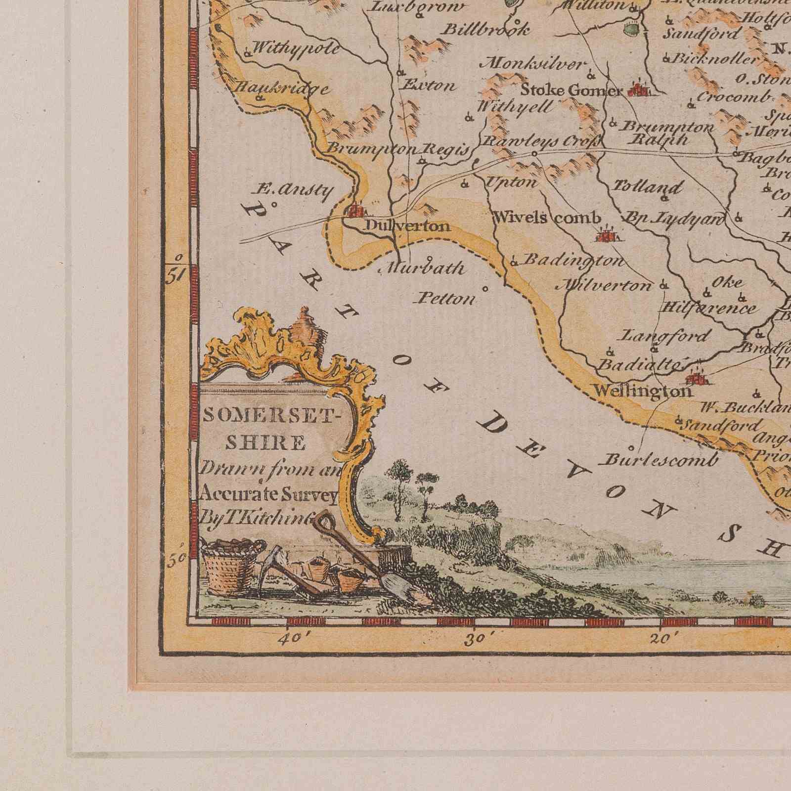
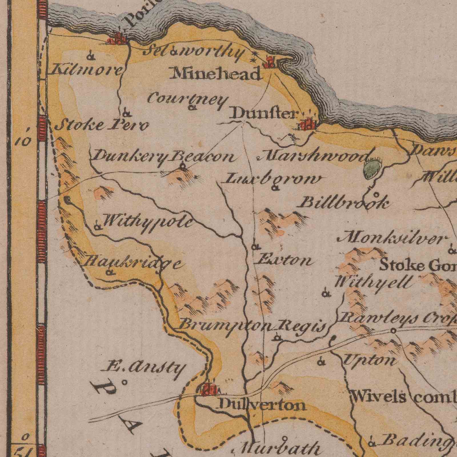
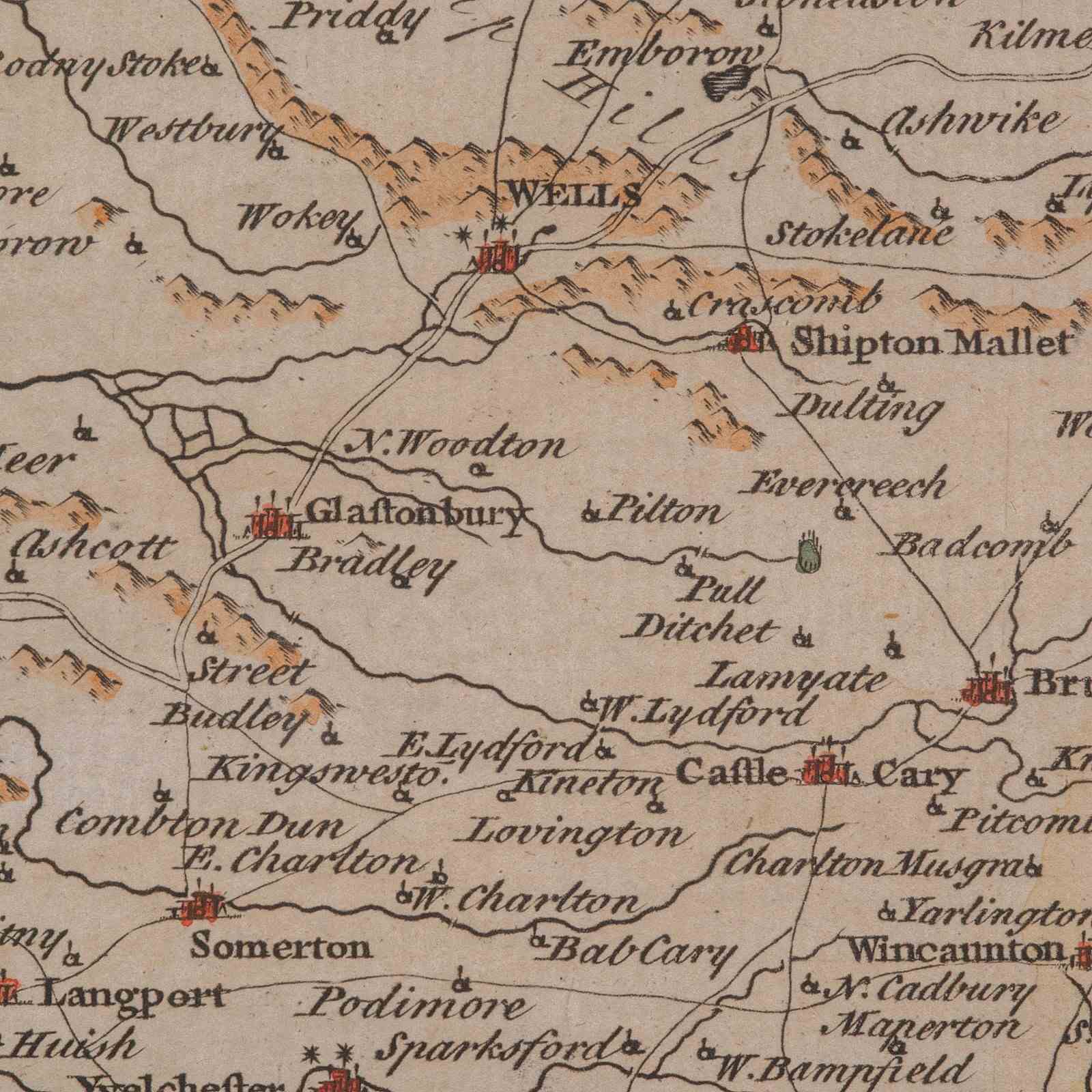
This is a fine antique Somerset map. An 18th century English cartographic county reference engraving by Thomas Kitchin (1718–1784), dating to the Georgian period, circa 1780. A beautifully detailed piece of cartographic history, offering charm and educational value in equal measure.
Fascinating county map of Somerset, in the South West of England, steeped in historical significance
Created by renowned British cartographer Thomas Kitchin, famed for his detailed copperplate engravings
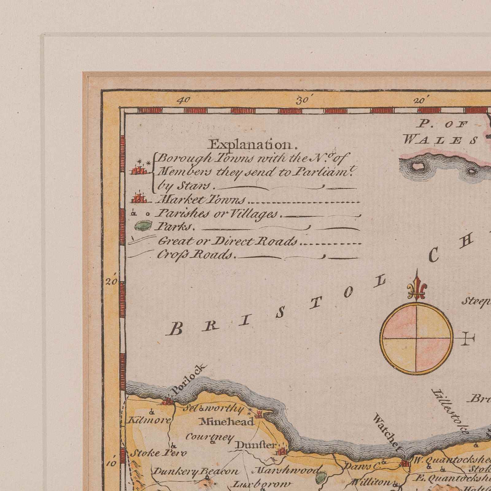
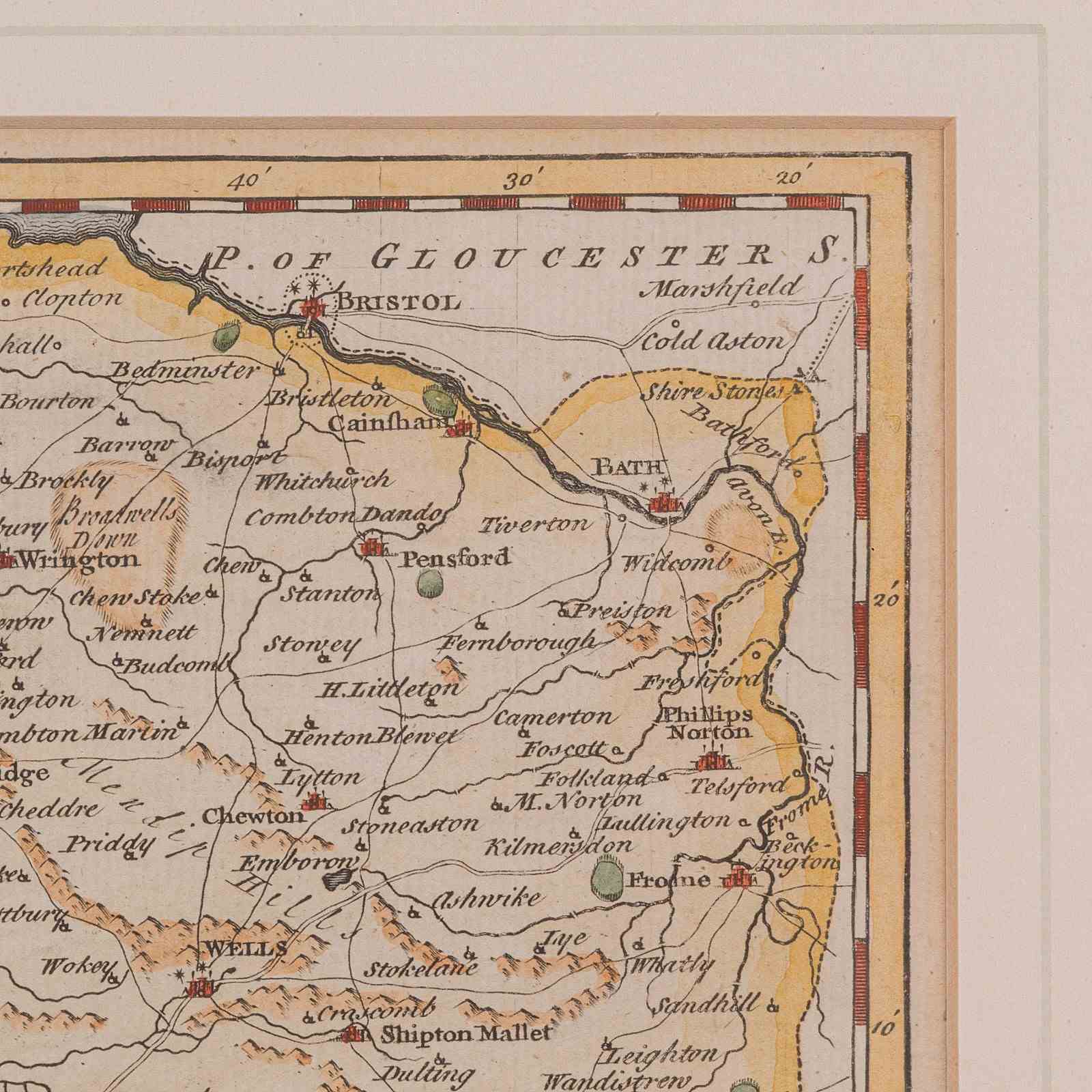
Features fine period detail, with towns, estates, and roads clearly annotated throughout
Includes a map key to the upper left and scale marker in English Miles to the lower right
Presented behind a clear glass pane, preserving the paper and enhancing visual clarity
Mounted within a tasteful gilt-finished frame, complementing both classic and contemporary interiors
Dressed to the rear with braided hanging cord for immediate and secure wall placement
A desirable piece for map collectors, local historians, or Georgian interior styling
This elegant antique county map of Somerset is a superb decorative and educational piece, showcasing Thomas Kitchin’s masterful cartography. Ready to grace the wall of a study, hallway or heritage-inspired living space. Delivered ready for the home.
Dimensions:
Max Width: 41.5cm (16.25'')
Max Depth: 1.5cm (.5'')
Max Height: 35cm (13.75'')
Map Width: 25.5cm (10'')
Map Height: 19cm (7.5'')
Item Info
Seller
Seller Location
Hele, Devon
Item Dimensions
H: 35cm W: 41.5cm D: 1.5cm
Period
1780s
Item Location
United Kingdom
Seller Location
Hele, Devon
Item Location
United Kingdom
Seller Contact No
+44 (0)207 1833511
More from LONDON FINE ANTIQUES