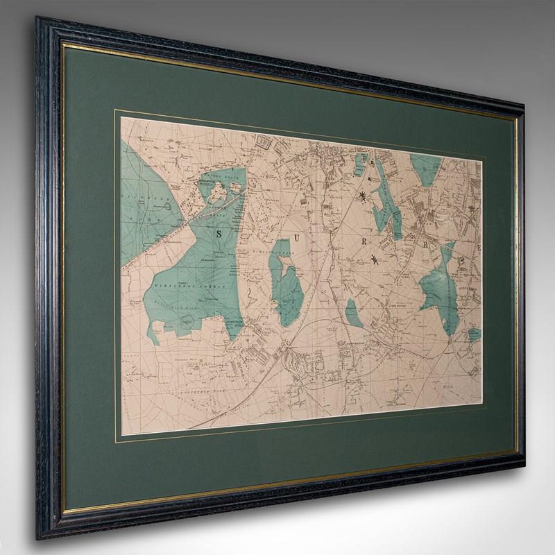


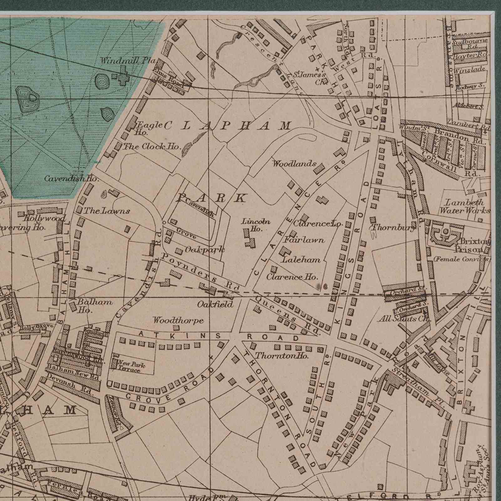

Large Antique Wimbledon Map, SW London, English, Framed Cartography, Victorian
Stock No
24438
2024
- £395.00
- €477 Euro
- $499 US Dollar
Questions about this item?
Like this item?
Item Description
Our Stock # 24438
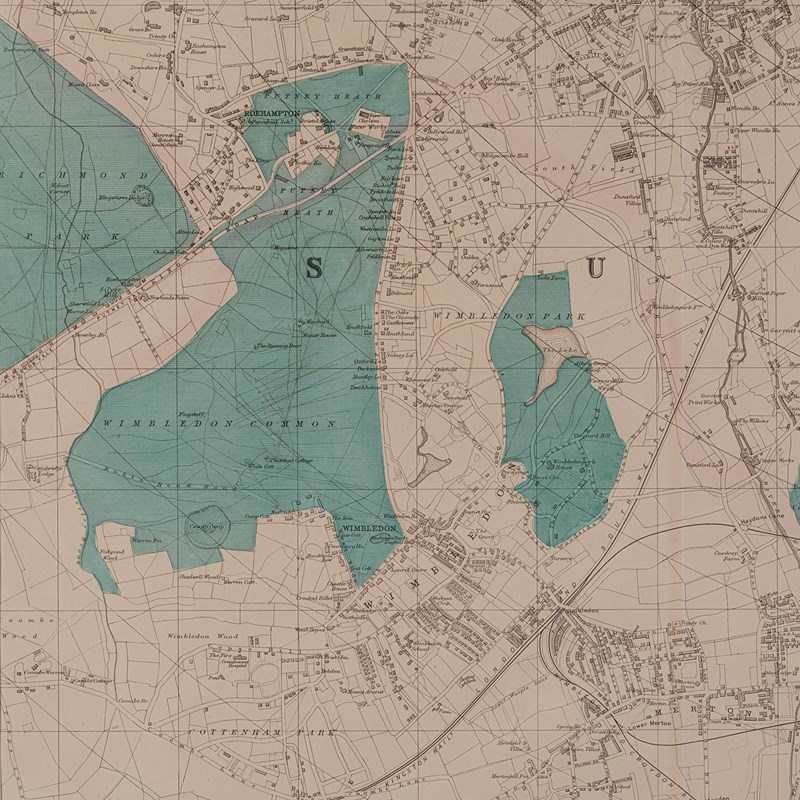
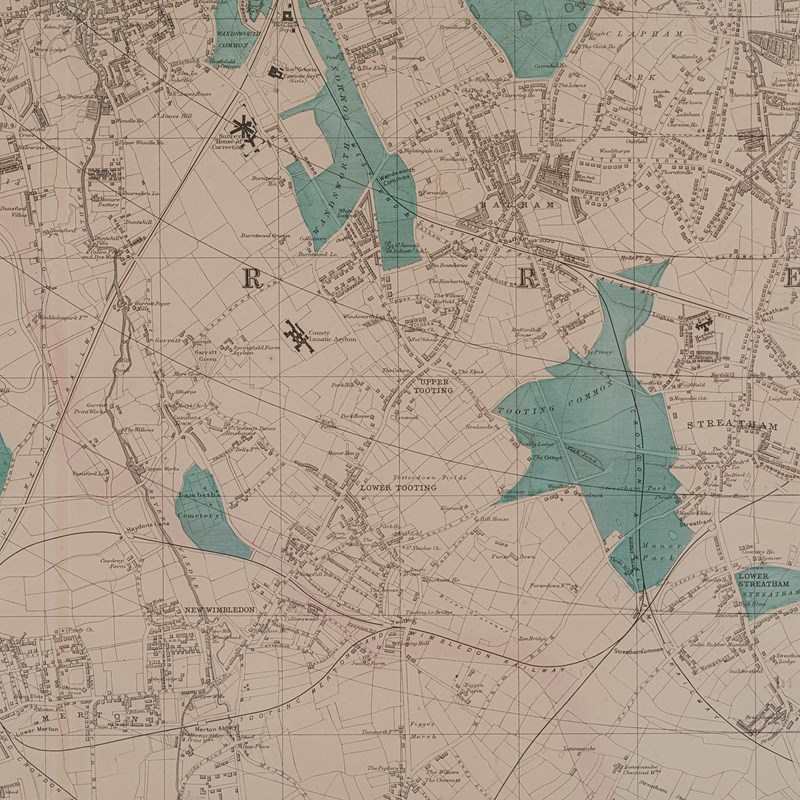
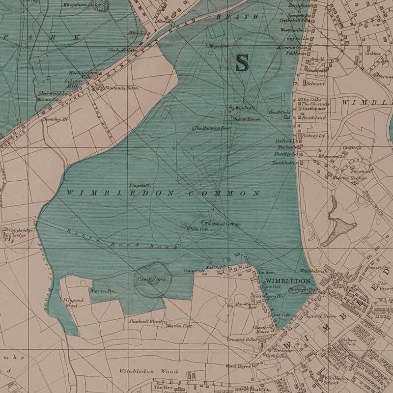
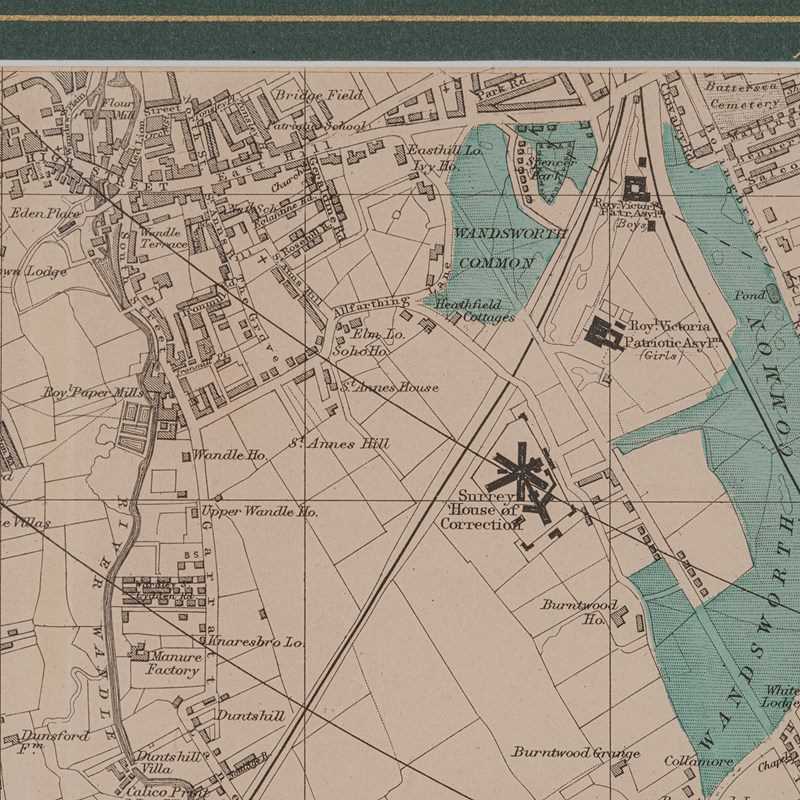
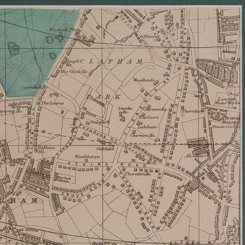
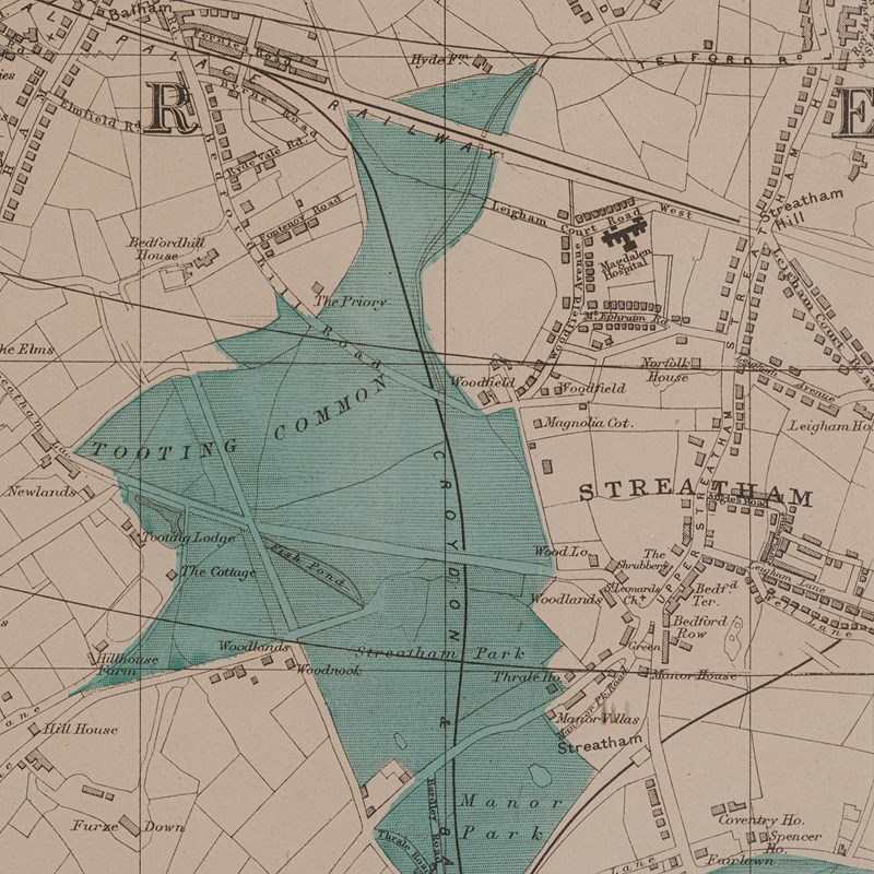
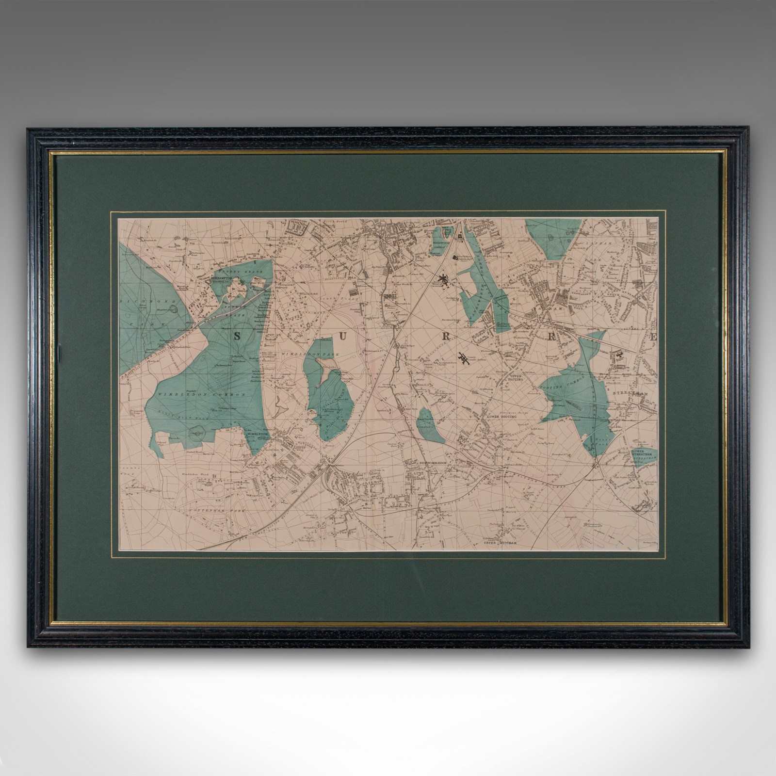
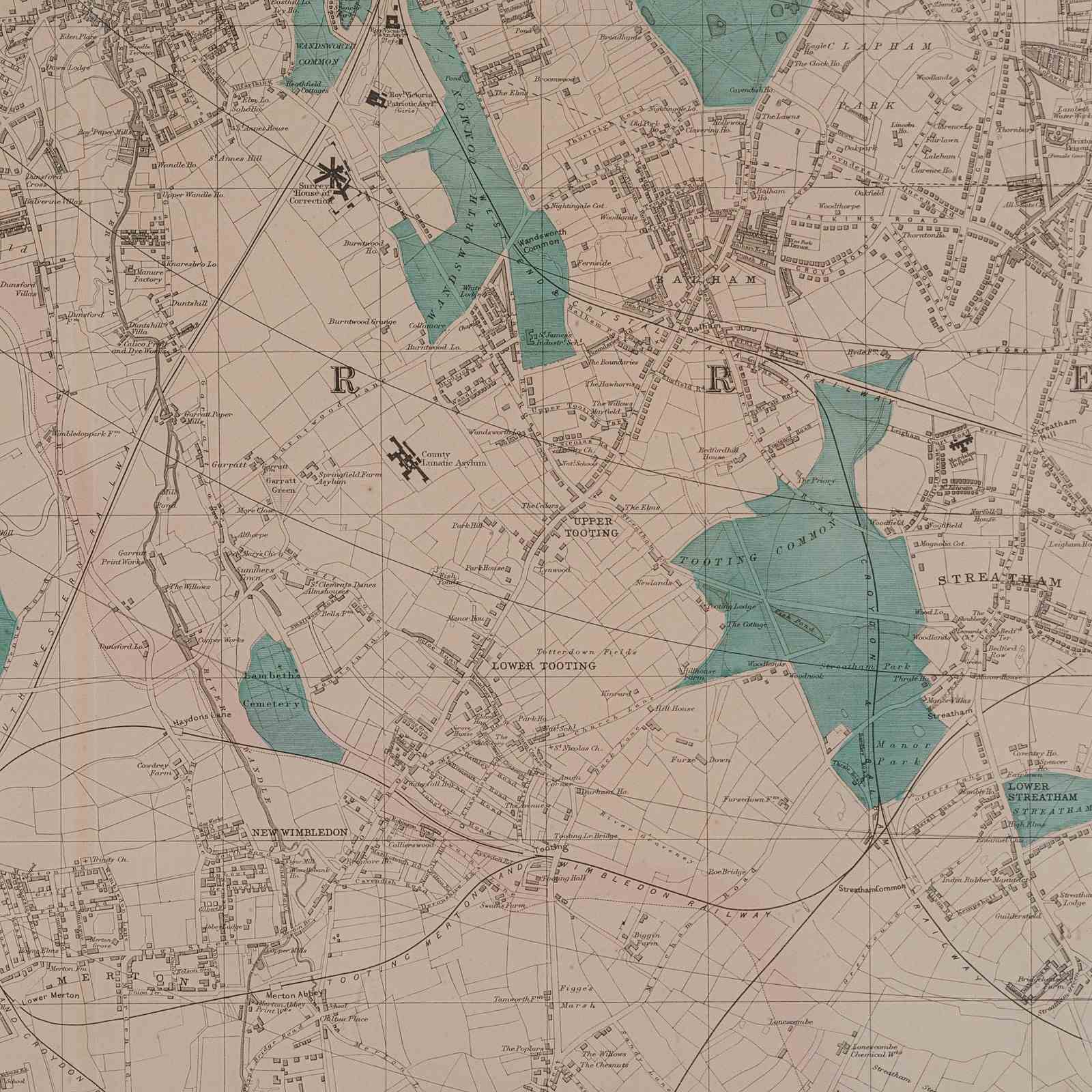
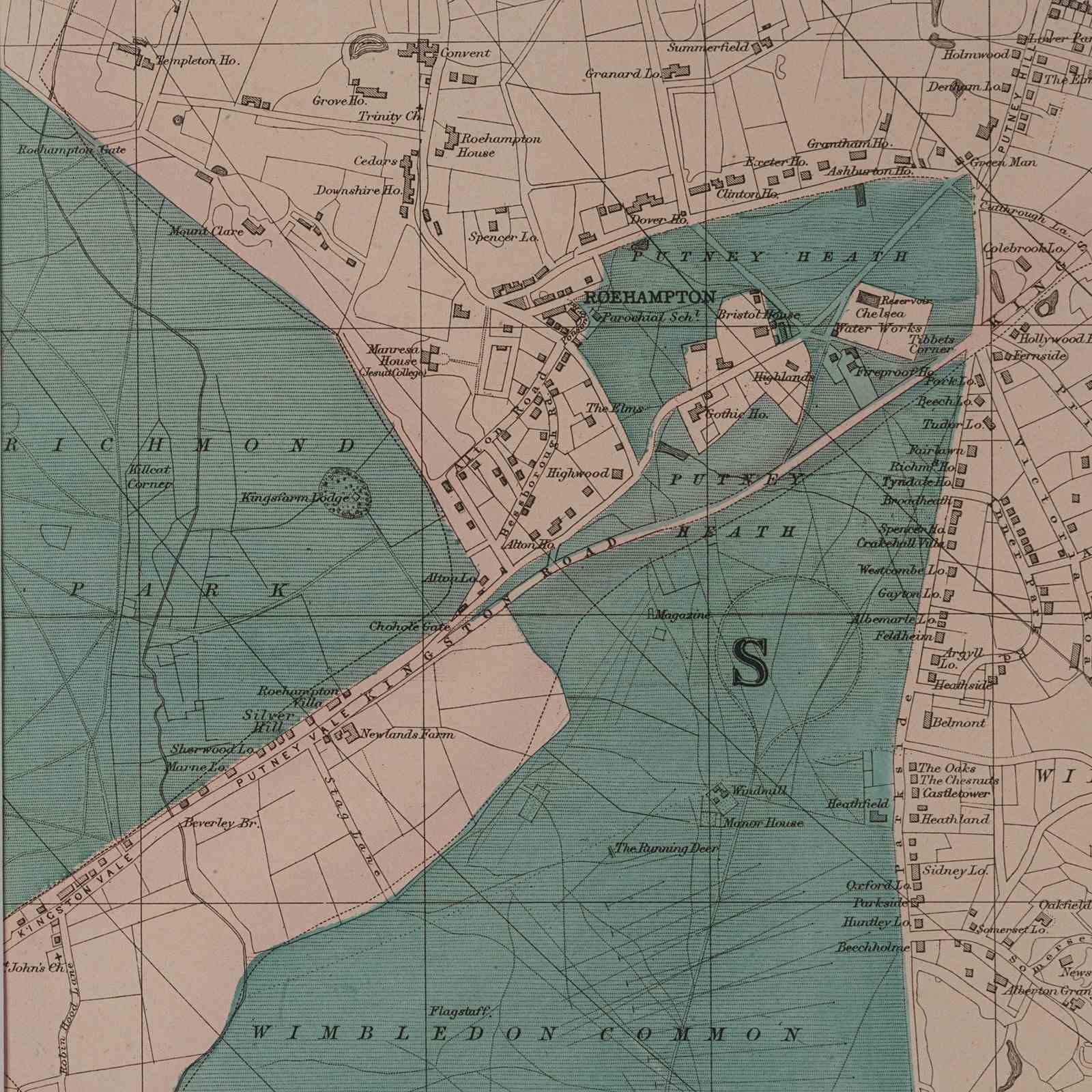
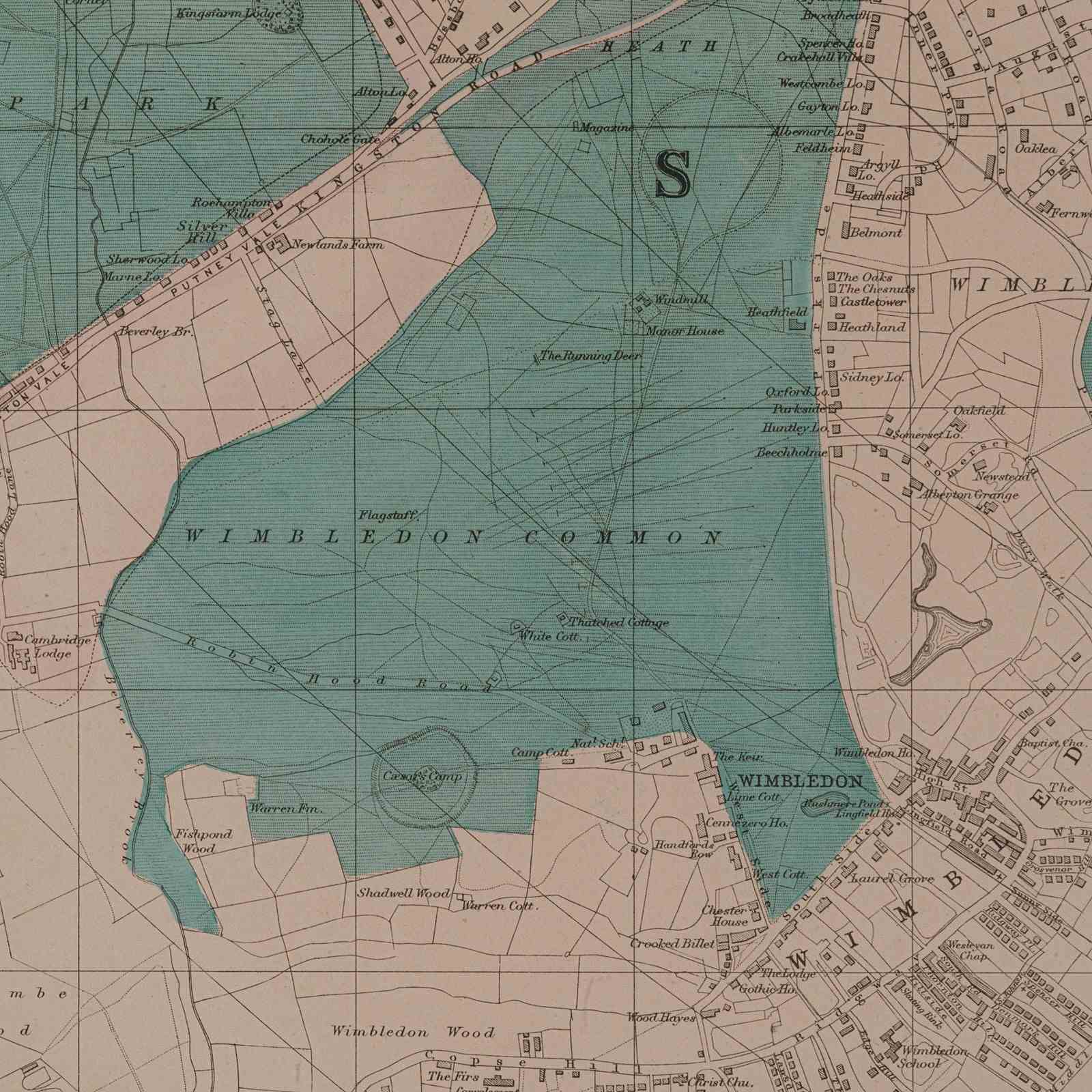
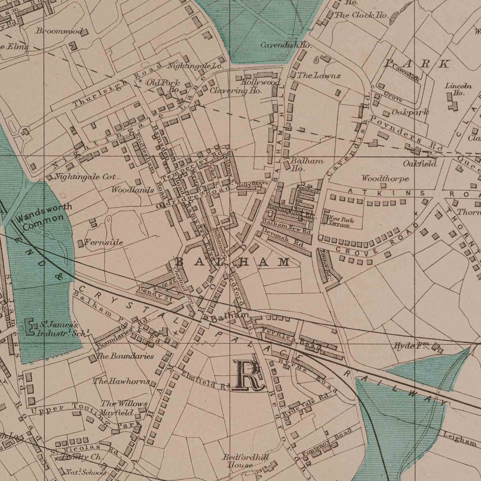
This is an antique town map of Wimbledon, South West London. An English, framed atlas engraving of cartographic interest, dating to the late Victorian period and later, circa 1885.
- Large scale cartography of Victorian South West London, perfect for display
- Displays a desirable aged patina and in very good order
- Fascinating cartography, appealingly set within a quality, later frame
- Several parks coloured in green, with places of interest marked in black ink
- Unattributed, but in the cartographic manner of George Washington Bacon (1830 - 1922)
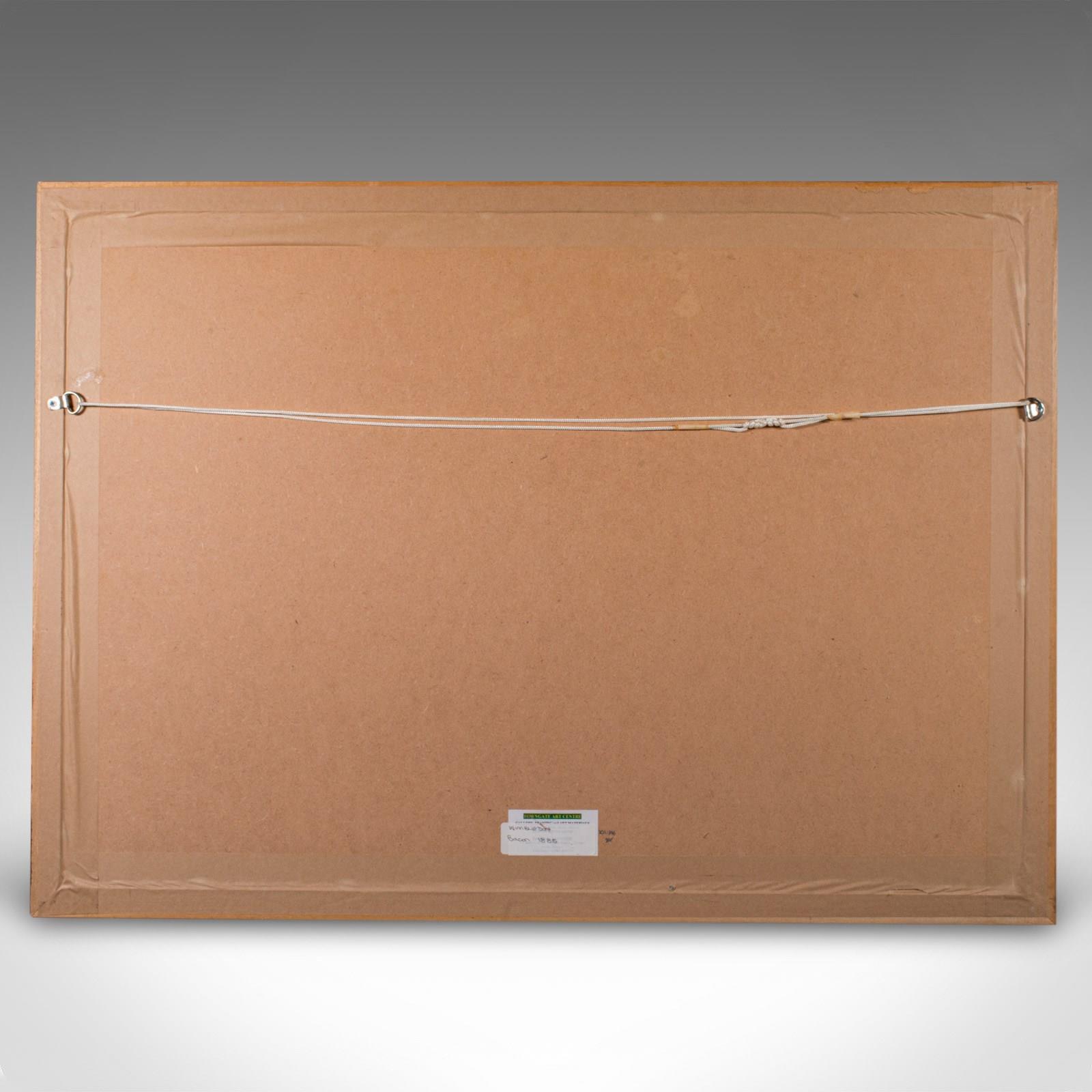
- Dressed to the rear with hanging cord for ease of mounting
This is a quality antique town map of Wimbledon and South West London, with fine cartographic interest. Delivered ready to display.
Dimensions:
Max Width: 80.5cm (31.75'')
Max Depth: 2cm (.75'')
Max Height: 58.5cm (23'')
Map Width: 60cm (23.5'')
Map Height: 37cm (14.5'')
We offer a 100% satisfaction guarantee with all of our antiques.
We ship worldwide with professional packing and attractive rates – please send us your post / zip code and country for a quote.
Free delivery to most of the U.K. – Please send us your post code for confirmation.
Deliveries taking on average ten working days to arrive at your door from receipt of payment.
Please contact us if you require any further information - we are here to help.
Our Ref: 24438
Item Info
Seller
Seller Location
Hele, Devon
Item Dimensions
H: 58.5cm W: 80.5cm D: 2cm
Period
c.1885
Item Location
United Kingdom
Seller Location
Hele, Devon
Item Location
United Kingdom
Seller Contact No
+44 (0)207 1833511
More from LONDON FINE ANTIQUES