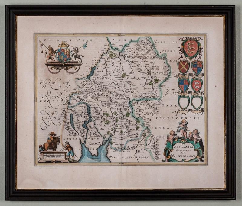

Map Of Westmoria (Westmorland) By Joan Blaeu.
Stock No
4966
2015
- £695.00
- €814 Euro
- $926 US Dollar
Questions about this item?
Like this item?
Item Description
A fine map of Westmorland from an atlas first published in 1645 by Joan Blaeu, (Dutch 1596-1673).
After 1645 there followed successive editions until the plate was destroyed in 1672, presumably in the great fire at the Blaeu publishing house in that year.
This map shows the hundred boundaries, rivers, woods, parks and settlements together with the relevant coats of arms for the county.Framed and glazed, overall dimensions: 26 inches x 22 inches
The Blaeu publishing house was established by Willem Blaeu, Joan Blaeu’s father, in 1599, originally as instrument and globe makers.
Item Info
Seller
Seller Location
London, London
Period
18th Century & Earlier
Item Location
United Kingdom
Seller Location
London, London
Item Location
United Kingdom
Seller Contact No
+44 (0)207 7275263
+44 (0)7831 561042
More from WALPOLES